


During high water and heavy rain events, the Districts implement emergency action plans to keep levees and facilities functioning to protect life, property, and the environment. We work closely with partner agencies, landowners, and non-profit and community organizations to ensure a coordinated approach during emergency events. Our key emergency partners include:
Multnomah County Emergency Management
Portland Bureau of Emergency Management


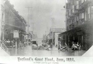 Heavy precipitation throughout the Columbia River basin during the 1893-94 winter led to heavy snowpack. This was followed by a dry, warm spring resulting in a massive snowmelt. There was still heavy rainfall in the lower basin, contributing to the flooding. Water levels remained at major flood levels (31.3+ NAVD88) for 38 days. The Districts were not formed at this time.
 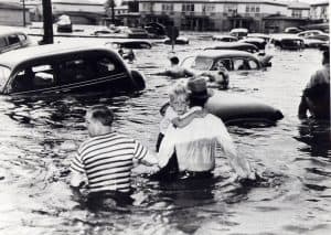 Heavy precipitation in the Columbia River basin throughout the winter led to heavy snowpack. Early spring had little precipitation and few warm days. May brought heavy rainfall and warm temperatures, which created heavy snowmelt in late May causing flooding throughout the entire basin. Water levels remained at major flood levels for 26 days. Levees/embankments breached in PEN 1, PEN 2, and MCDD.
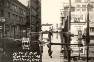 Persistent heavy precipitation in the Columbia River basin started in October of 1955 through February of 1956. Heavy rainfall in the northern Columbia basin continued in March. Snowpack in higher elevations started by the end of October, and by springtime snowpack was much higher than usual. Warm temperatures in late spring augmented the snowmelt. Water levels remained at major flood levels for 12 days. The Districts’ system performed well.
  Unusual cold weather in early December was followed by heavy snowfall. Subsequently there was warm, persistent, heavy rains later in the month. December rainfall that year was more than 3.5” above average in the Portland area. Water levels remained at major flood levels for 2 days. The Districts’ system performed well.
 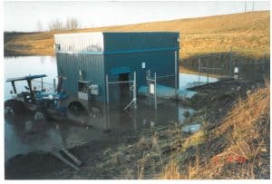 The season had heavy snowfall, ice, and warmer temperatures earlier in the season. Floodwaters were fed by heavy rains and melting snow. The Portland Airport area received about 7 inches of rain in a four day period. The Willamette River reached 28.6 feet (WRD) in height and crested the downtown Portland seawall (33.8 NAVD88). The Districts’ system performed well, erosion and seepage were main concerns.